
The Races
-
The Ogopogo Extreme
The main event. A brutal day starting at 5am with a 3.8km swim in the dark. A punishing 182km bike leg through wineries and orchards before summiting to Apex Mountain ski resort, with a grueling 3100m elevation. Finishing off with a spectacular 42km trail run over the mountains with 1950m elevation. You have 19 hours to conquer the epic Ogopogo Extreme.
Entry pre 1st January 2027 - C$500
Entry post 1st January 2027 - C$600
-
Ogopogo 3500
It might be half the distance, but with 3500m elevation, it packs a punch! 1.9km swim as the sun rises. Over 2000m of elevation in just 83km means once you start going up, you don’t stop. With the same stunning first 20km of the Extreme run course you collect 1369m of elevation over 25.2km to push you to your limit.
It is not the Extreme but it is no walk in the park!
Entry pre 1st January 2027 - C$450
Entry post 1st January 2027 - C$500
-
Ogopogo Extreme Relay
The Ogopogo Relay is for those who wish to share this epic course, and a little suffering, amongst their friends and family.
Teams can consist of 2 or 3 people. The relay is only available for the Extreme.
Entry pre 1st January 2027 - C$650
Entry post 1st January 2027 - C$750
Ogopogo Extreme & Relay
The Courses
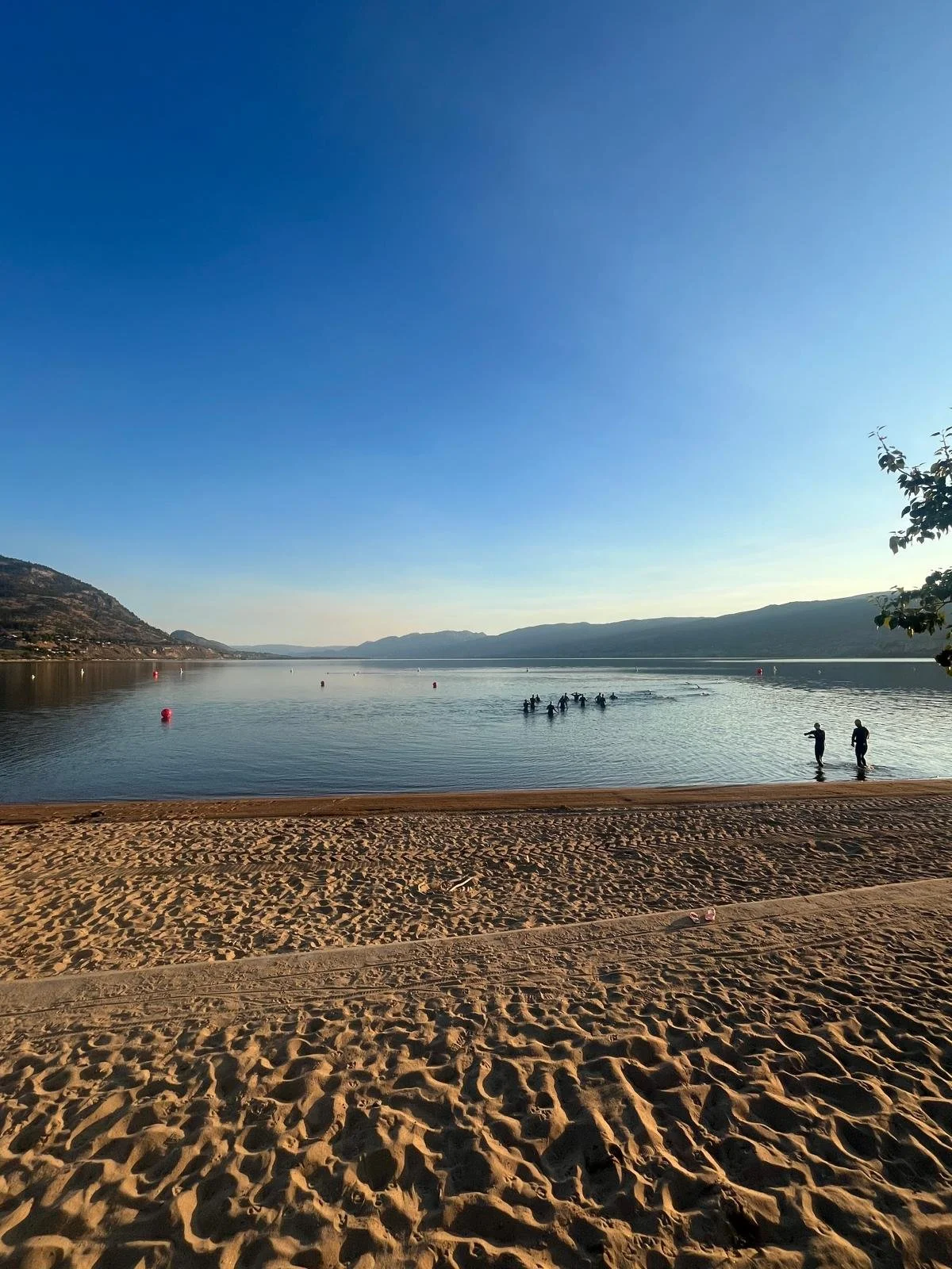
Extreme Swim Course - 3.8km - 2 loops
A 2 loop swim starting at 5am, in the dark, from Skaha beach. The buoys will be lit and a lit kayak will lead the swim to help athletes with sighting. At the end of the first loop there will be an Aussie exit to start the second loop.
Athletes are required to swim with a swim buoy with a light and their GPS tracker inside.
After the second loop athletes exit up the beach into T1.
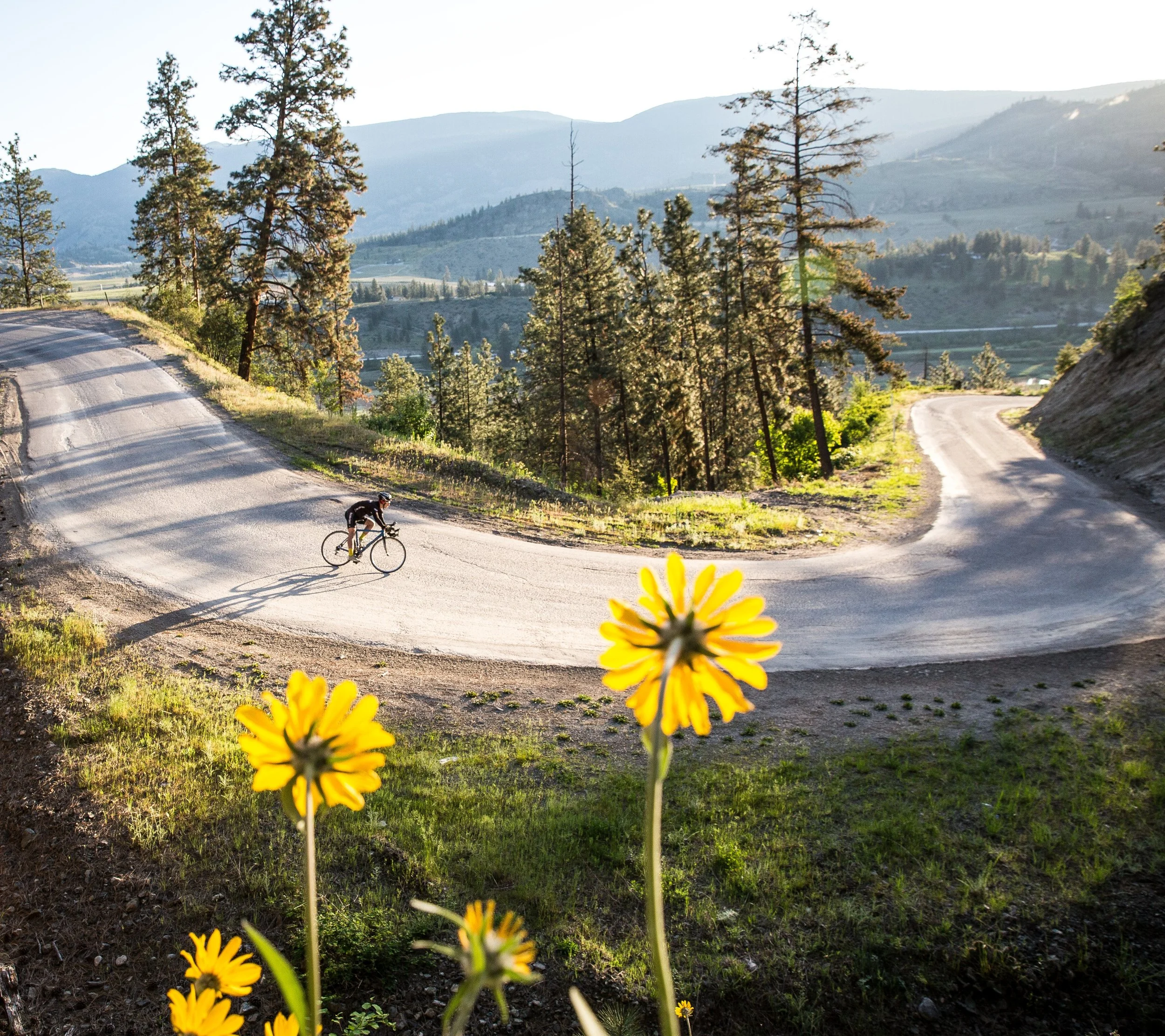
Extreme Bike Course - 183.4km - 3100m elevation
The course takes athletes along the East side of Skaha Lake before the first climb up Mclean Creek and down into Okanagan Falls. After crossing the highway athletes take on ‘The Wall’ up to See Ya Later Ranch.
The course then rolls through Willowbrook, Fairview and down to Osoyoos. This is a beautiful section through the valleys, orchards and wineries.
Up next is the first major climb of Richter Pass, followed by a rolling section to Keremeos.
At Keremeos the climbing really starts. A 22km gradual climb up to Twin Lakes is followed by a 9km out and back. (4.5km down, 4.5km back up) Support vehicles are not allowed on the out and back.
Athletes briefly return down the highway before climbing 14km up Green Mountain Road. Then you turn onto Apex Road for the 10km climb to Apex (avg grad 8.1%, max 13.1%). This road has three cattle grids athletes will have to cross.
Once you have summited you will then roll downhill into town before climbing through town to T2.
Athletes must follow the rules of the road at all times. The course has turnings across roads that will not have traffic control. You are responsible for your safety.
The bike course can be found here.
The race directors may need to change the course but any changes will be clearly communicated.
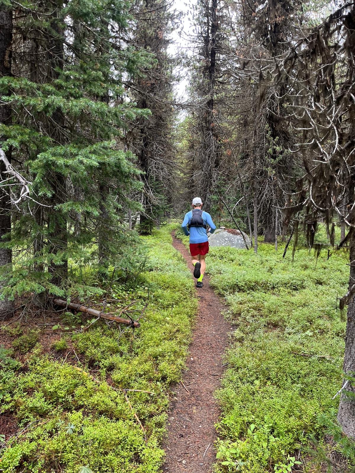
Extreme Run Course - 42.2 km - 1954m elevation
The run starts with a downhill section on the road before switching to trail to the base of Beaconsfield Mountain. The first of two major ascents.
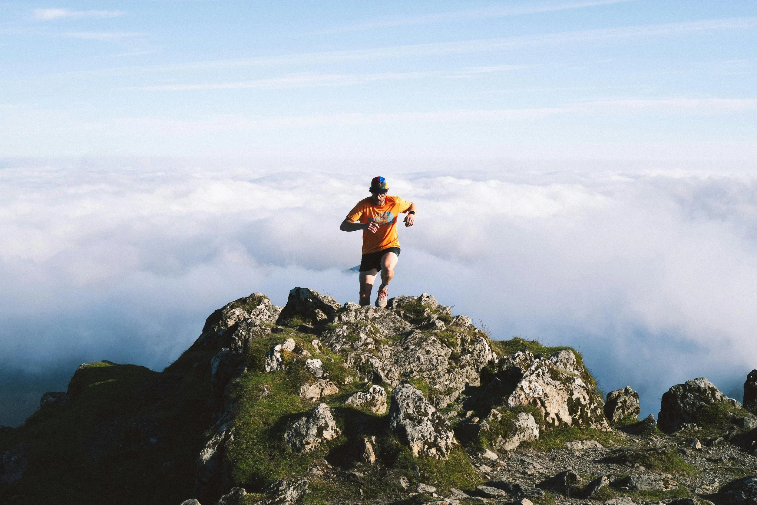
The Beaconsfield Mountain climb is 2.7km with 550m elevation. From the summit there is a brief down and up before descending to the bottom of Apex Mountain.
The Apex Mountain climb is also 550m elevation over 2.6km. From here you have spectacular 360 degree views of the whole region.
With most the climbing out the way, the route follows a gradual descent for 5km through beautiful alpine forest. At 23 km you will be able to meet your supporter to top up on supplies.
The course then rolls through the Nickel Plate Park and round Nickel Plate Lake before descending down towards the Nickle Plate Mine.
Before you reach the mine the trail takes you back into the forest as you head back on the final few kms to the finish where you will be greeted by the race directors and your supporters as you finish.
The Extreme & Relay run route can be found here.
The race directors may need to change the course but any changes will be clearly communicated.
Ogopogo 3500
3500 Swim Course - 1.9km - 1 loop
A 1 loop swim starting at 5:30am as the sun rises over Skaha beach.
Athletes are required to swim with a swim buoy with a light inside and their GPS tracker inside.
After completing one loop athletes exit up the beach into T1.
3500 Bike Course - 83.3km - 2160m elevation
The course takes athletes along the East side of Skaha Lake before the first climb up Mclean Creek and down into Okanagan Falls. After crossing the highway athletes take on ‘The Wall’ up to See Ya Later Ranch.
The course then rolls into Willowbrook where it turns right, away from the Extreme course. There is one cattle grid (uphill) exiting Willowbrook that cyclists will have to cross.
The route includes the punchy climbs of Fairview White Lake Road before turning onto White Lake Road (rejoining the Extreme course). Support vehicles are not allowed to turn left on White Lake Road. They must go around via St Andrews and rejoin at Twin Lakes.
Athletes descend on the highway briefly before climbing 14km up Green Mountain Road. Then you turn onto Apex Road for the final 10km climb to Apex (avg grad 8.1%, max 13.1%). This road has three cattle grids athletes will have to cross.
Once you have summited you will then roll downhill into town before climbing through town to T2.
Athletes must follow the rules of the road at all times. The course has turnings across roads that will not have traffic control. You are responsible for your safety.
The bike course can be found here.
The race directors may need to change the course but any changes will be clearly communicated.
3500 Run Course - 25.2km - 1369m elevation
The run starts with a 4km downhill section to get to the bottom of Beaconsfield Mountain which is the first of two major ascents.
The Beaconsfield Mountain climb is a 2.7km with 550m elevation. From the summit there is a brief down and up before descending to the bottom of Apex Mountain.
The Apex Mountain climb is also 550m elevation over 2.6km. From here you have spectacular 360 degree views of the whole region.
With most the climbing our the way, the route follows a gradual descent for 5km through beautiful alpine forest. Here you will be able to meet your supporter to top up on supplies.
There is one final section past Mt Riordan, before a gradual descent to T2 and the finish line.
The run course can be found here.
The race directors may need to change the course but any changes will be clearly communicated.